
|
A set of Python software tools for analysis and visualization of 3D X-ray fluorescence data sets. |
| Description |
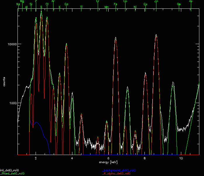
Started in 2001, MAPS serves as the main analysis tool for XRF micro-probes at the APS. It features analysis methods for elemental maps, spectral, spectrum, and non-negative matrix data. It operates in batch mode, and also has an interactive GUI. Originally written in IDL, the analysis code was re-cast in Python. Please Note: This software is being deprecated in favor of the XRF-Mapper tool. |
| Distribution |
| https://github.com/MapsPy/MapsPy |
| Acknowledgements |
|
MAPSPy has been developed as a collaboration between the APS Scientific Software Engineering & Data Management group, the Microscopy Group, and Mirna Lerotic of 2nd Look Consulting. In particular, Arthur Glowacki, Stefan Vogt and David Vine have been the main contributors. This project has been produced using operational funding from the APS, contract DE-AC02-06CH11357. |